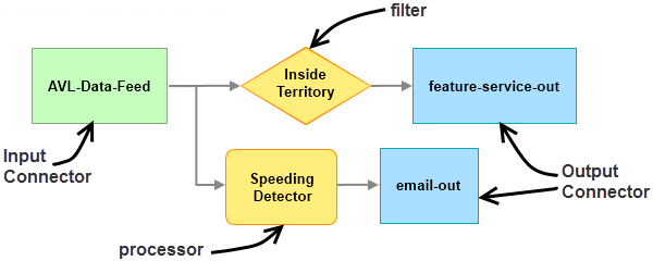
GeoEvent Services allow you to define the flow of event data (GeoEvents) and apply any real-time filtering and processing to the GeoEvents as they flow through GeoEvent Server. A service designer defines the flow of GeoEvents from an input connector to an output connector, adding optional filter and processor elements to the service, and connects these elements together to create a GeoEvent Service. The connection between two elements is called a route. The final step is to publish the GeoEvent Service; this starts the service and the real-time processing of the event data.

For details on creating GeoEvent Services, see Creating a GeoEvent Service.